According to McKinsey, 98% of construction megaprojects suffer cost overruns and delays, while 77% of projects are at least 40% late… Fortunately, construction tech has emerged with various solutions in tow. “I call that moving from an art to a science,” explains Sue Klawans, the SVP of the US-based Gilbane Building Company. We may have heard a lot about BIM, information systems and data processing, but less so of task automation for monitoring work sites. Nonetheless, progress in the sector is happening at a remarkable rate, calling on emerging technologies such as drones and LIDAR. Here’s a quick overview of three start-ups leading the way:
At Doxel, drones are joining the team.
In Silicon Valley, Andreessen Horozwitz is a sign of quality. When it comes to this venture capital company who were one of the first – and most inspired – on the scene, whenever they invest in a business or new technology, people sit up and take notice. This is what happened when Doxel received a $4.5 million investment led by the well known investor in January 2017. In fact, the start-up uses technology often found in autonomous cars, such as LIDAR or HD cameras, to survey construction sites in finer detail. Mounted on drones that can fly or drive, these digital imaging devices roam relentlessly both indoors and out – and without the need for an operator. They then transfer the data to an artificial intelligence engine which is designed to analyze the images, measuring the site’s progress while precisely detecting errors. In a pilot project carried out on the Kaiser Permanente medical office in San Diego, the results were outstanding, with an increase in productivity by around 38%.
Paracosm: a magic wand for construction sites.
After having received $3.3 million investment in 2014, Paracosm was eventually acquired three years later by Occipital, the software development studio who specialize in computer vision, completing its range of spatial mapping products. This time round there are no drones, but human operators who control the handheld PX-80, a 3D-scanner capable of mapping an area 100 meters in all directions. The device produces point clouds (300,000 points per second), which draw the outlines of the scanned structure with a margin of error of 2 to 3cm. It can also easily be interfaced with major software like BIM, so Paracosm’s tool allows the user to regularly compare the real construction with the 3D model. This ensures significant times gains, and more importantly, 3D-model optimization, which often remain under-used after the conception phase.
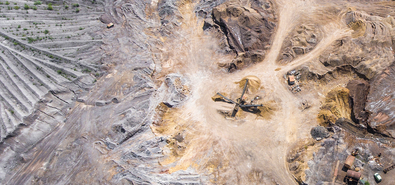
Propeller: data analysis platform
Propeller develops a suit of tools to optimize their use and efficiently process mapping data from work sites. AeroPoints and the Propeller Platform are two complementary products that aim to simplify project monitoring in industries like construction, mining, and even waste management… The former is a smart ground control point which enables drones to map in detail a work site (to a margin of 2cm). The data is not processed in real-time but uses desktop-based processing, making it much more precise. The second component is a collaborative platform, featuring an integrated mapping tool allowing several users to work on the same map simultaneously and providing essential tools such as measuring volumes and distances.