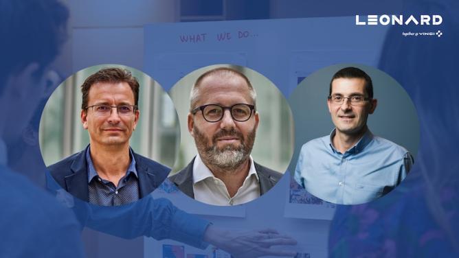
Hovering Solutions provides an integrated offering for 3D scanning of underground infrastructure using autonomous flying robots. Founded and led by Fran Espada, it is one of ten startups selected to be part of Leonard’s Catalyst 2022 program.
AVUS.DIGITAL enables construction companies to exploit aerial data by integrating it into existing processes. Christian Wörner and Andreas Ellinger are in charge of developing this solution. They were part of the LEONARD AI program and are now part of the Intrapreneurs program.
Your two solution offerings are different but share the use of drones. How did you come up with the idea of investing in this technology?
Fran Espada: I have always been passionate about robots and technology. When I was a kid, I used to play with electric motors and other home-made electronic kits. More recently, before launching Hovering Solutions, I worked for a developer designing solutions applied to underground exploration. In 2015, as part of a project for the London Underground, the opportunity arose to develop a drone to digitalize the Underground tunnels and I decided to start an entrepreneurial venture in this area.
Christian Wörner : Like Fran, I’ve always been fascinated by electronics, computers and all things technological. I bought my first drone in 2015 to make films. Then I started using them for my professional activities as a civil engineer. At that time, drone mapping was a niche activity, especially in Germany. When I joined VIA IMC in 2018, I was convinced that drones would play an integral role in construction, and we started building the AVUS.DIGITAL drone platform. Today, we enable many construction companies to use drones and help them create digital twins of the construction sites they work on.
What makes your two solutions unique?
Fran: Hovering Solutions has developed a type of autonomous drone that can estimate its position and navigate in underground areas, in the dark and in the absence of GNSS data. No pilot is required during operation and radio communications can be lost without affecting the autonomous navigation capabilities of the robot. These unique features extend the range of underground exploration up to 7 km and allow for movement at up to 5 metres per second. They also allow for the production of a realistic and accurate 3D digital model of the areas covered.
Christian: It is important to us that our platform and services integrate seamlessly into the construction process. From surveyors to construction managers or our colleagues in billing and project control – everyone needs to be able to make the most of aerial data. We have therefore developed an intuitive and easy-to-use user experience, while removing software barriers, for example for one-click exports to other GIS and CAD software, or for working directly on the platform and exporting PDF reports or CSV files. Two more unique aspects: we offer all-inclusive flight packages (with professional pilot and permissions) and – we do not limit the number of data users. We believe that projects thrive on the sharing of data between all those involved.
Can you detect and recognise objects, or do you only provide scans to your customers?
Christian: Our platform offers many features for working on 2D and 3D scans in the browser, such as measurements and annotations, and seamless export to various CAD and GIS software. This makes our solution perfect for a wide variety of use cases in the field of construction and infrastructure. At the same time, we are already working on many different use cases to detect specific conditions, evaluate quantities or identify general defects (e.g. the conveyor belt project we carried out as part of the LEONARD AI programme and the development of our stock AI for AVUS.DIGITAL). My colleague Andreas Ellinger and I have just joined the LEONARD intrapreneurship programme to be supported on all these issues.
Fran: We provide the data for the digital models by means of a comprehensive 3D visualisation system. This tool allows our clients to virtually navigate underground areas from their offices, simply using a standard web browser. It also allows the detection of unexpected objects obstructing water tunnels and other anomalies. This saves time and avoids putting people’s lives at risk. Like AVUS, we are also working on AI tools to automate the detection of anomalies, avoiding human intervention even during the post-analysis phase.
What about the business development of your respective solutions?
Fran: Our business model is called Robot-as-a-Service (RaaS). We do not sell robots, but the data we generate. This does not require any CAPEX investment. We offer recurring contracts to our customers, in a monthly subscription model where they pay a subscription fee that allows them to regularly scan their facilities according to their needs. We have ambitious growth plans for this year 2022, as well as continuing to open up new markets and grow internationally. The technology is protected by two patents filed with the EPO and PCT.
Christian: As we focus on very industry-like workflows, it can be easily integrated into all existing processes. In addition to our core business, namely the AVUS.DIGITAL platform and the drone flight offering, we launched the AVUS.DIGITAL flight school in 2021. We have already trained many site managers and surveyors to become professional drone pilots. Our goal for 2022 is to increase this number further and enable more VINCI Group companies to take advantage of the technology around aerial data. In the future, we will focus on the automated calculation of drone data.
Where do you see the technology in 5 years?
Christian: We are at an incredible time and we are seeing a surge in the possibilities of large-scale data collection and processing. In 5 years’ time, I can imagine that we will have regular autonomous flights to construction project sites. These flights, combined with many other data sources and sensors, will allow us to automatically infer information about the progress and condition of roads, buildings and industrial assets and will have a fundamental impact on the way we work. I look forward to the future of automation and robotics in construction.
Fran: I agree with Christian. The technology will be in continuous development in the coming years and even decades. Our flying robots will be equipped with more sensitive and accurate sensors, combined with AI algorithms, to perform missions in more complex underground scenarios (such as large water distribution networks). This process will be accompanied by a significant miniaturisation of drones.
From a market perspective, we are witnessing a new paradigm for the digitisation and maintenance of underground infrastructure. In the same way that the technology simply did not exist five years ago, its use will be mandatory in my view within five years.
Fran Espada : f.espada@hoveringsolutions.com
Christian Wörner : christian.woerner@via-imc.com
This article was published as part of the Leonard newsletter. Subscribe to receive future ones by following this link.


